Thematic
Advertisement
ILWIS Open v.3.6.0.1
ILWIS Open integrates image, vector and thematic data in one unique and strong desktop package. It delivers a wide range of feautures including import/export, digitizing, editing, analysis and display of data,
Advertisement
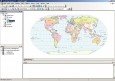
CartoMAP Viewer v.2.0
CartoMAP Viewer can help you to view GIS files.CartoMAP Viewer Features: 1. Use with any database 2. Supports for ArcView shape and MapInfo files 3. Import DXF Entities 4. Various spatial analysis functions 5. Various thematic routines 6. Automatic

Mul tmath for kids
Math puzzles. Interactive education. A lot of math information for teachers, Mathematics lessons for elementary, middle, and high school including geometry, fractions, and algebra. This section of The Lesson Plans Page contains math lesson plans, math
BioniX Wallpaper Changer
BioniX Wallpaper Changer is a FREEWARE Windows software that can change your desktop wallpapers at every Windows startup, once a day or at chosen intervals. The images can be stored in different directories, on different hard disks, even on different
AvisMap Free Viewer
The free AvisMap Viewer opens most GIS/CAD and raster image file types and most ArcView, ArcExplorer, and MapInfo projects. Besides just opening and viewing files, the Viewer supports an extensive list of features including visual layer properties
FreeView v.10 3
Geomatica FreeView is a flexible data viewing tool supporting over 100 raster and vector formats for loading, viewing, selection, and enhancement. FreeView is useful for any geospatial data viewing application, and is freely distributable.
Geomatica FreeView v.9. 1. 2005
Geomatica FreeView is a flexible data viewing tool supporting over 100 raster and vector formats for loading, viewing, selection, and enhancement. FreeView is useful for any geospatial data viewing application, and is freely distributable.
WinChips v.4 7
Chips, the Copenhagen Image Processing System, is a general-purpose software package for remote sensing image processing and spatial data analysis with extensive support for NOAA AVHRR data.
Gismaps Viewer v.1. 3. 3524
Gismaps Viewer is a GIS viewer that can be used for geospatial analysis and map production.
StatPlanet v.2 3
StatPlanet is a browser-based interactive data visualization and mapping application. Use it to easily and rapidly create visualizations from simple Flash maps to advanced infographics. StatPlanet can be freely and easily hosted on your own website.
GSpatial Toolbar v.2. 2. 2004
ESRI shapefiles are a very common mapping or GIS dat exchange format. Google Earth uses an exchange format called KML, which is a variant of XML.